Earthquake in New York: About the Ramapo Fault Line
The confirmed earthquake in the late morning hours of Friday, April 5th caught residents of New York and New Jersey by surprise. Social media was flooded with questions about the seismic activity that was felt across the tristate.
Earthquakes in New York State
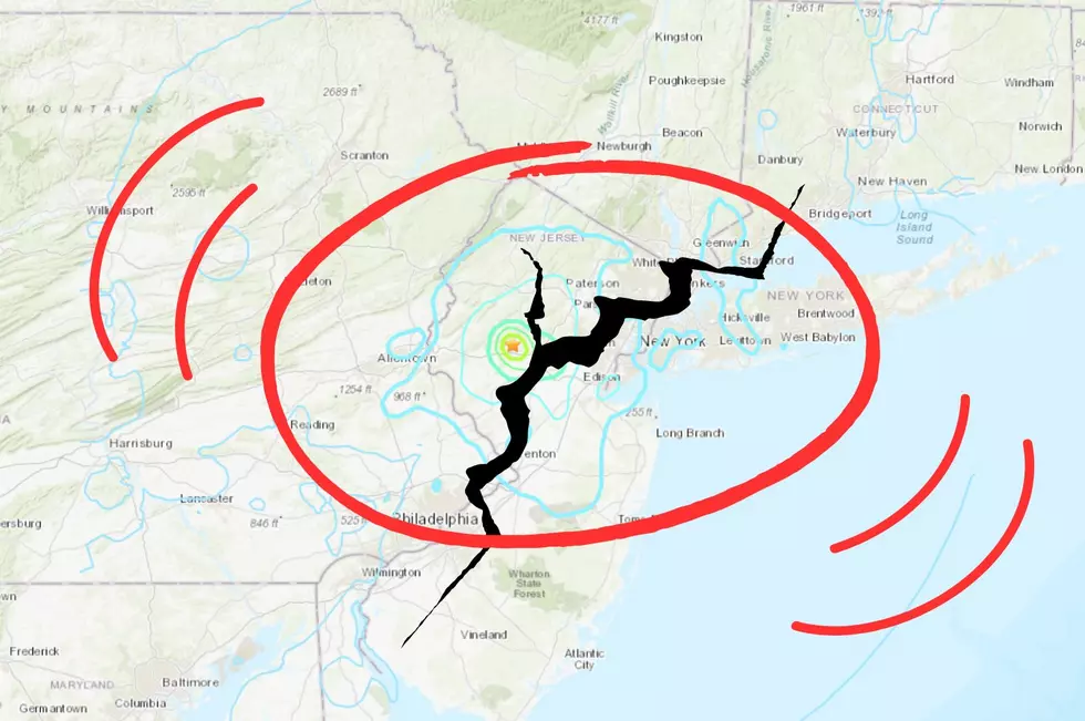
While earthquakes are far more common on the west coast of the United States, this was far from the first time tectonic plates have shifted in the Northeast (below). The 4.8 magnitude of the event on April 5th, however, was one of the largest recorded quakes in the area.

The Ramapo Fault in New York and New Jersey
The United States Geological Survey (USGS) reported the epicenter of the earthquake as roughly four miles north of Whitehouse Station, NJ, a town located very close to the Ramapo Fault, the longest fault line in the northeast.
What Is the Earthquake Magnitude Scale?
Earthquakes are measured in orders of magnitude ranging from 2.5 and lower (described as "usually not felt, but can be recorded by seismograph") to 8.0 and higher ("can totally destroy communities near the epicenter"). The 4.8 magnitude quake in the tristate falls between the range of 2.5 and 5.4, defined as "often felt, but only causes minor damage".

While earthquakes are a natural disaster like hurricanes and forest fires, they are unique in how difficult they are to predict (the USGS goes a step further, calling major earthquake prediction as "impossible"). Take a look at New York's strongest quakes below, and keep scrolling to get started on your emergency "go bag".
44 of Biggest Earthquakes to Shake New York State
Gallery Credit: Credit - Polly McAdams
Must-Have Items In Your Emergency Go-Kit
More From WRRV-WRRB